Kingsport
A planned city on the Holston River with a nine-mile greenbelt.
Community guide · Tennessee
A railroad town that grew into the region's university and medical center, with a downtown that turned its floodwater into a park and a mountain preserve at its southern edge.
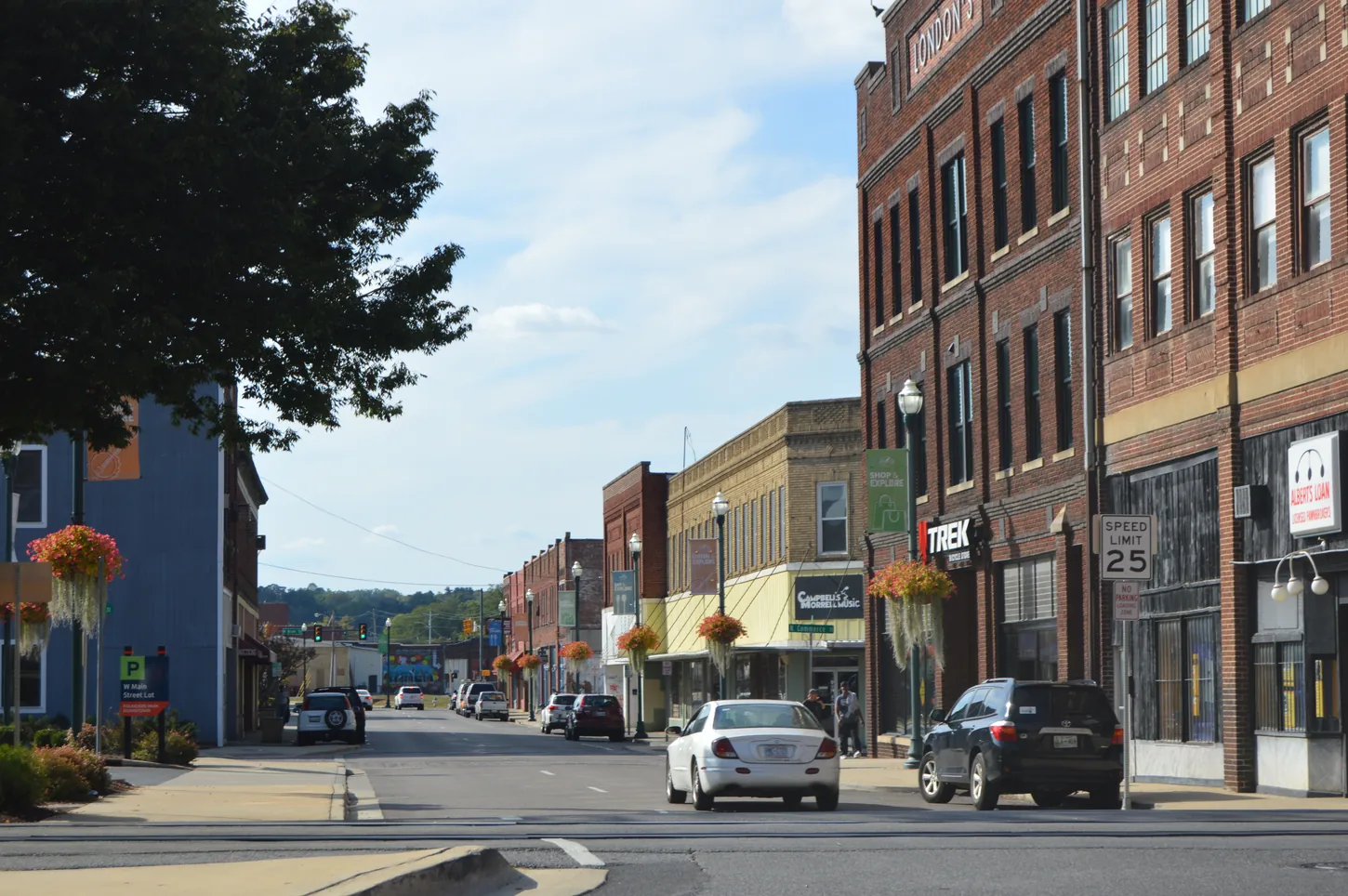
Johnson City began as a stop on the rails. In 1856 Henry Johnson's station, known as Johnson's Depot, gave the settlement its name, and the town was incorporated in 1869. Several rail lines eventually met downtown, and the brick commercial blocks that grew up around them still give the city's center its storefront character.
The 20th century added the institutions that define the city today. East Tennessee State University, the region's main medical center and the James H. Quillen VA Medical Center at Mountain Home make Johnson City the Tri-Cities' center for higher education and healthcare. With 71,046 residents at the 2020 Census, it is also the largest of the three cities.
Geography completes the picture. Buffalo Mountain rises along the southern edge of the city, and the Watauga River arm of Boone Lake reaches its north side, so a short drive in either direction leads to a trailhead or the water.
The clearest symbol of downtown's recent change is Founders Park. The roughly five-acre green space opened in 2014 as part of a stormwater project designed to reduce chronic downtown flooding, and the City points to it as an example of turning flood-prone land into public space. Today it holds an amphitheater, walking paths along the creek, public art and the pavilion used by the farmers market.
The historic core around it is protected by two National Register districts. The Johnson City Commercial Historic District covers blocks of Main, Market, Buffalo and Roan streets, with Classical Revival and Art Deco storefronts. The Warehouse and Commerce Historic District preserves the rail-era industrial buildings to the west. Many of those buildings now hold restaurants, coffee shops, breweries, galleries and event spaces, and the start of the Tweetsie Trail is a short walk away.
The West Walnut Street corridor, which links the ETSU campus with downtown, was rebuilt by the City with new utilities, storm drains, sidewalks on both sides, on-street parking and a bike lane. The public work is finished; private redevelopment along the street continues property by property, so check the current status of any specific building.
Founders Park hosts summer concerts and the Johnson City Farmers Market, and Winged Deer Park on Boone Lake is home to the City's Lakeside Concert Series. The long-running Blue Plum Festival is not returning in 2026, according to its organizers, so check current calendars rather than older listings.
Visit Johnson City: events and attractions · City of Johnson City
Johnson City's neighborhoods are shaped by the university, the medical corridor, the mountain to the south and the lake to the north. These areas are a useful starting point, and every address still needs its own jurisdiction check.
Listed on the National Register in 1996, the Tree Streets Historic District takes its name from its tree-named streets. It developed in phases from 1892 and includes Craftsman bungalows, Queen Anne and Colonial Revival homes built from the 1870s through the 1940s.
Residences within and near the downtown historic districts put Founders Park, the farmers market and the Tweetsie Trail within walking distance. Availability is limited and changes often, so we look at current options together.
Areas near the ETSU campus, Johnson City Medical Center and the VA campus at Mountain Home offer short commutes for students, faculty and healthcare professionals. Blocks near campus can mix owner-occupied and rental homes, so zoning and use rules matter.
Almost all of Boones Creek has been annexed by Johnson City, yet many of its homes still carry Gray mailing addresses. Toward Boone Lake, the north side includes Winged Deer Park and its public boat access.
Neighborhoods on the south side sit closest to the forested trails of Buffalo Mountain Park and to the medical corridor along State of Franklin Road.
Gray is an unincorporated community in Washington County, outside city limits. Jonesborough and Elizabethton are separate towns with their own governments and services, each a short drive away. A Johnson City mailing address does not by itself establish city limits.
Johnson City's housing follows its growth from rail town to university city.
Craftsman bungalows, Queen Anne and Colonial Revival houses in and around the Tree Streets and the older streets near downtown.
Ranch and two-story homes from the post-war decades, typically on mature, tree-lined lots.
Construction toward the edges of the city, including the Boones Creek area, and in surrounding Washington County.
Properties in the surrounding counties, where well water, septic systems, private roads and broadband become part of the due diligence.
Older homes can bring specific inspection questions, from wiring and plumbing to drainage near creeks. We plan for those details on every showing.
Few small cities have a rail-trail, a mountain preserve and a lake within their limits.
About 9.5 miles of compacted stone on the former East Tennessee & Western North Carolina Railroad, nicknamed the "Tweetsie" for its steam whistles. It runs from Johnson City to Elizabethton and passes near Sycamore Shoals State Historic Park.
A city nature preserve of about 725 acres on the north slope of Buffalo Mountain, acquired in 1994. It is steep and forested, and it is used mainly for hiking and nature programs.
About 200 acres on Boone Lake with public boat access, sports fields, picnic shelters and the Goulding Amphitheatre, home of the City's Lakeside Concert Series.
Downtown concerts, the farmers market and creekside paths in the park built to manage floodwater.
Tweetsie Trail (Visit Johnson City) · City parks and recreation
East Tennessee State University enrolled 14,388 students in fall 2025, according to the university. Its colleges of medicine, pharmacy and nursing tie it closely to the region's healthcare system.
Ballad Health, the region's hospital system, is headquartered in Johnson City, and Johnson City Medical Center is its largest hospital here. The James H. Quillen VA Medical Center at Mountain Home serves veterans across Tennessee, Virginia and Kentucky. Healthcare, higher education and the VA are consistently named among the area's largest employers, alongside manufacturers and a broad base of local businesses.
Employment changes over time, so review employers' current information directly rather than treating any list as a job forecast.
East Tennessee State University · Ballad Health · Mountain Home VA
Interstate 26 runs through Johnson City, connecting northwest to Kingsport and southeast toward Asheville. U.S. 11E, 19W, 23 and 321 also meet here: U.S. 321 is the main route toward Elizabethton, and 11E heads toward Jonesborough. Tri-Cities Airport in Blountville handles commercial flights.
Travel times depend on the starting address, route and traffic. Try your actual commute at the times you expect to travel.
Johnson City spans Washington, Carter and Sullivan counties. The county affects your property-tax bill and some services, and a Johnson City or Gray mailing address does not establish city limits. We confirm both early for every property.
Tennessee assesses residential property at 25% of appraised value. Homes inside the city pay a city rate plus the rate of the county they sit in. Use current figures from the City and the county trustee for any estimate; no rate is printed here because rates change.
Johnson City Schools serves most addresses inside the city. County districts serve other addresses, including much of the surrounding area. A mailing address or a nearby campus is not a school assignment; confirm the zone for the specific property with the district. This is a directory, not a ranking.
Johnson City Schools · Washington County Schools · Sullivan County Schools
Founders Park exists because downtown creeks flood. For any property near a creek, check mapped flood hazards and ask about drainage history.
Most of the city is in Washington County, but parts are in Carter and Sullivan counties. County property records confirm it, and it affects taxes and some services.
Sometimes. Much of Boones Creek has been annexed by Johnson City but keeps Gray mailing addresses, while Gray itself is unincorporated. Confirm the parcel's jurisdiction rather than relying on the address.
Ask the applicable district about the exact address and current attendance zone. A nearby school or neighborhood name is not a guarantee.
BrightRidge serves the city and much of Washington County, including fiber internet in parts of its territory. Confirm service for the exact address.
About 9.5 miles, from Johnson City to Elizabethton, on a former railroad line.
To reduce downtown flooding. It opened in 2014 as part of a stormwater project, and it is a good reminder to check flood maps near creeks.
Choosing the right part of Johnson City usually comes down to how you want to spend your days: near campus and downtown, close to the lake, or tucked toward the mountain. Having relocated to Northeast Tennessee myself, I know how much easier those decisions are with a clear picture of the area. Let's talk about what you're looking for.
Talk with MarshallReviewed October 15, 2026. Sources are linked throughout; information changes, so confirm the details that matter to your decision.
Historical source records; external links and facts require an updated review before production use.
Plan your next step: First-time homebuyer guide · Preparing to sell your home · Moving to the Tri-Cities · Explore community guides